

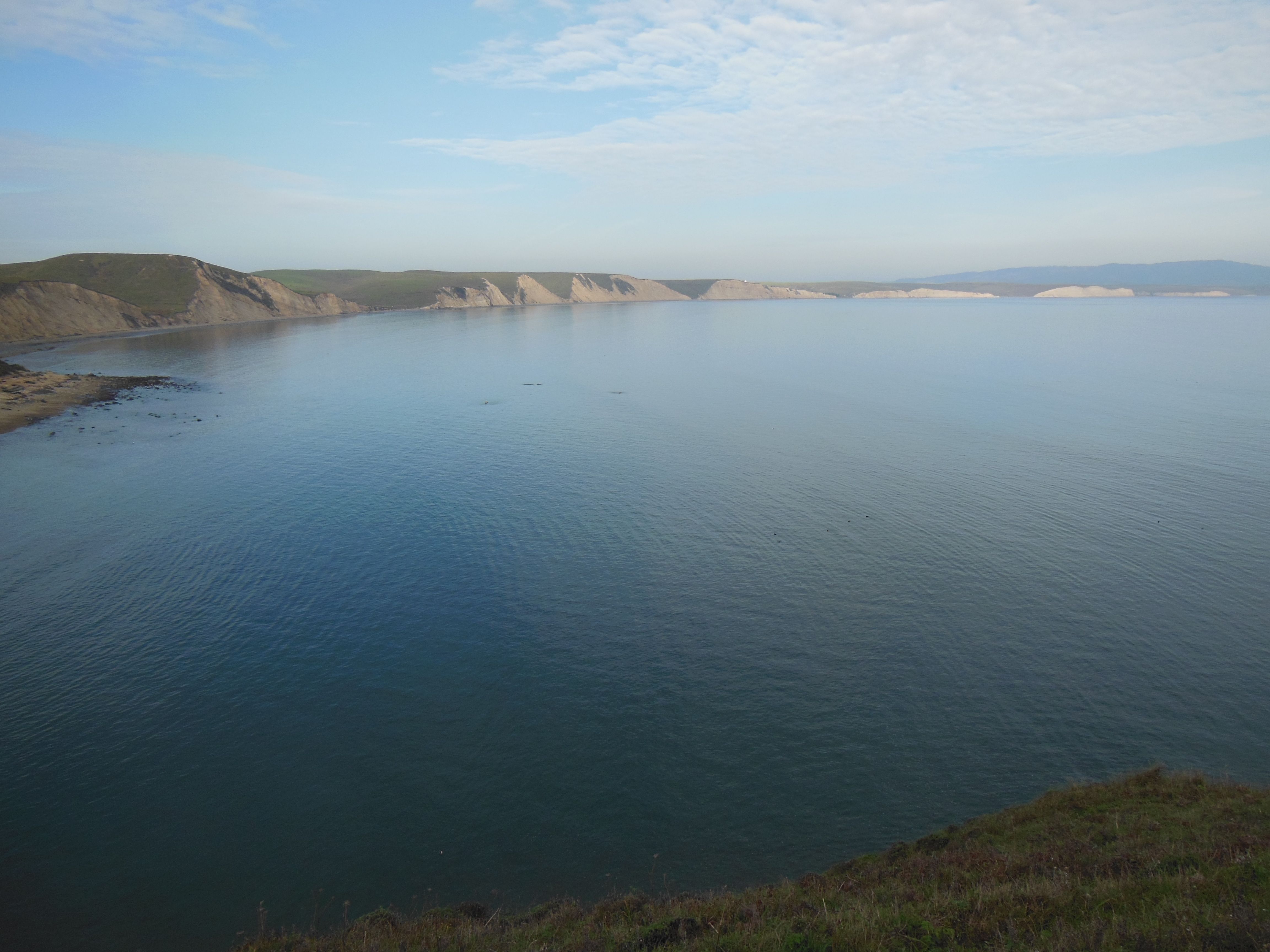
I’ve always enjoyed hiking, and camping is something I’ve rediscovered over the past few years after a rather long hiatus since my girl scout days (but I still remember those camping trips to Sunset Beach!). However, never have I combined the two in the form of backpacking until earlier this month. We’d been talking about it for a while — after all, this is a skill that will let me see more of the national parks — and some good friends, much more experienced outdoorspeople, had offered to help us through our inaugural experience.

First stop was REI to use up our member coupons and dividends to procure new camping backpacks and a few other essentials. Good thing about going with experienced friends was that we didn’t need to buy all the gear, but we did get some good quality insulating layers since the forecast was calling for temperatures in the 20s and our own water filter (trust me – you don’t mess with giardia, giardia messes with you!). Next stop: the Desolation Wilderness in the El Dorado National Forest near South Lake Tahoe. Side note: I took my first non-scout camping trip in Death Valley and first backpacking in Desolation Wilderness – I’m sensing a theme here.

Our friends truly tried to take it easy on us on this single-night camping trip: We started from a parking lot near Wright’s lake, where the forest service has a seemingly nice summer campground facility, and hiked the ~5 miles or so into the Desolation Wilderness to Twin Lakes. Not a long hike, but the elevation went from 7000 ft at Wright’s Lake to ~8200 ft at Twin Lakes. I tend to need a day or so to adjust to higher elevations, so between that and some other extenuating circumstances, I was really struggling with the uphill. Add in the dropping temperatures and nerves about backpacking for the first time, and I was admittedly pretty miserable the first day (I was missing the Final Four for this?). In my defense, I still contend that the term “leisurely hike” is relative when you’re talking about trudging through snow and ice to get to a frozen lake… The scenery could not be beat, however!


We set up camp next to a large boulder near the outlet to the lake. Our trusty guides had brought along a few extras to help deal with the cold temps, including an extra sleeping bag, battery-powered heated gloves (amazing!), and the makings of warm backcountry pizzas cooked up on the little backpacking stove. I was quite impressed by the pizzas – campmade dough and everything! The nighttime brought cold winds, but I stayed fairly cozy in the the sleeping bag(s) and tent. When I had to get up in the middle of the night, there was definitely snow crunching underfoot, but it didn’t stick through to the morning.

In the morning, we said goodbye to the lake – it really was quite an amazing site all frozen and covered in ice! Fueled up with hot cocoa and oatmeal spiked with dried apples and trail mix, we headed back down to the car. I only fell on my butt once while trekking over the fresh ice, and in general I was able to appreciate the hike and the landscape a lot more on the way down. That being said, I was pretty excited to make it back to the car, even more excited to reach 4G range to find out Duke was going to the NCAA finals, and even more excited to reach a veggie burger in Placerville. So, perhaps my first backpacking experience was not completed with as much ease as I had hoped, but under some slightly different circumstances, I think I would have really enjoyed this hike. I’ll definitely have to give it another go and (very) slowly work my way up to being a backcountry camper!


 we saw lots of lizards, including two chuckwallas. Chuckwallas can live up to 40 years and grow to something like 15 inches long. We saw an adult male, with the characteristic orange body and black head, and a female (or perhaps a juvenile?) with a greenish brown pattern and a striped tail.
 On our way out of town, I did stop in at the Indian Cove ranger station to pick up one of the passport cancellations I didn’t yet have for the park. Is it cheating if I didn’t stay at the campground? Oh well.


 center in the park.


 inclined to
 take that trip on!


 Princess is in a great location just about a 10 min drive past Grant Grove on CA 180 and a half hour from Cedar Grove. It is technically in the National Forest, but you do have to pay the NP entrance fee to get to it by road. It was actually a great location for being able to explore both Sequoia and Kings Canyon parks (at least those areas accessible by road from the west). The campsites were generally more spread out that what I saw in Cedar and Grant Groves, and some had a decent amount of privacy among the trees. We were in the “Shining Cloud” loop at site #50, which was ideally situated between some trees and had a nice open area out the back leading toward Princess meadow. The sites on either side of us also seemed pretty nice, although they were nearer to the other loops on one side or the bathroom (pit toilets) on the other. At the campsite, we had company from chipmunks, Douglas’ squirrels, and a little bat in the evenings!


 In my last post, I featured spots in Sequoia National Park, but it turns out, Kings Canyon holds its own when it comes to giant sequoias in addition to having gorgeous valleys, granite canyons, and meadows.


 continue East on 180 instead of heading south on the Generals Hwy, you’ll drive down the canyon walls into Cedar Grove and the section of the park that follows the Kings River deeper into Kings Canyon. This area houses the other large campgrounds within Kings Canyon, a visitors center near the campground (where you can find the passport cancellation), and an additional information stand at the aptly named Road’s End. From Road’s End, you can continue on foot 2-3 miles down either side of the river to a bridge. From the bridge, you can return to Road’s End the way you came or down the other side, head up the hill for Mist Falls (apparently “still misting away” this time of year) or head up the Bubb’s Creek Trail to the left.


 but I finally got a to take a long weekend this summer to visit a new (to me) National Park. Parks actually, since Kings Canyon and Sequoia are two adjacent National Parks managed together. I love the Sierras, and these parks just may rival Yosemite as my favorite NP! There were so many highlights to this trip, that this will have to be a multi-part post.


 Further into Sequoia National Park is the Lodgepole area, which has a visitor’s center, campground, market, and other facilities. Lodgepole is one of two places where you can get tickets for the Crystal Cave tour (the other is the Foothills VC near the southern entrance), but we didn’t have time for that one this trip. If you do plan to go into the cave, read the current restrictions on clothing and equipment before you go as efforts are underway to prevent the spread of white-nose syndrome from bat colonies in the Eastern US.


 Muir Woods is a beautiful example of a California redwood forest, with coast redwoods lining a shaded creek surrounded by ferns and a blanket of redwood sorrel. Unfortunately, it is also THE place for people touring CA to get a quick giant tree fix, so you get the trees without the tranquility. There are certainly better places to lose yourself in nature, including redwoods, but the scenery is still able to impress (and as you can see, I managed to get a few pictures without people in them!). Other highlights of the Monument (which likely also contribute to its popularity) are the educational programs and the boardwalked trails through the center of the park, which both protect the woods floor while also making the park more accessible to all visitors.


 If you must visit Muir Woods during summer weekends (as I apparently had to), it is highly recommended that you take the Muir Woods Shuttle (follow signs from the freeway). Another option if you are planning on doing more than just the boardwalk is to hike into the Woods from Mt. Tamalpais State Park. There are several options here: From the Mountain Home Inn, you can take the Panoramic and Ocean View trails into Muir Woods or follow Alice Eastman Road down to the Plevin Cut and Camp Eastwood trails.
 Pantoll Ranger Station, starting with the Stapelveldt and Ben Johnson trails and returning via Bootjack and Alpine. Up at the ranger station, it was all blustery fog and moss-covered trees, but we quickly lost the wind heading down the back side of the hill and had a pretty solitary hike until we got closer to Muir Woods. As you descend, you can see the redwood forest develop as you get further down into the watershed – it’s really quite a nice way to approach! All together, it ended up being about 8 miles and 4 hours, including some meandering about the visitor’s
  center and a stop on the trail for some lunch.
 problem with doing the hike this way is that the uphill is all on the way back! Using the TCC trail as a connector, you could do the loop we did from the end of the Muir Woods trail if you prefer to do the uphill first. My fitbit logged 147 flights of stairs – I was highly tempted to go up and down the stairs at my apartment 3 more times when I got home, but my knee was hurting from all the downhill hiking.


